
Steve Freihon/Related-Oxford
New York, New York
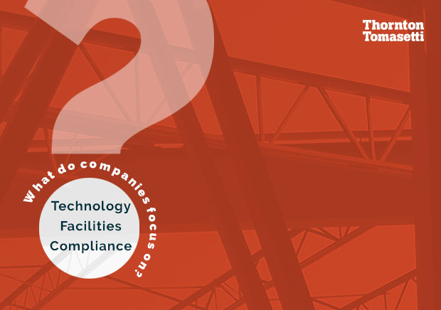
Global experience.
Regional perspective.
Local impact.
New York, New York
Australia

London, United Kingdom

Diriyah, Riyadh, Saudi Arabia
As the 2024 Atlantic hurricane season begins, we look back at 2023 and share some tips for evaluating building safety ahead of what’s predicted to be a historically busy year.
See More Hurricane Season Insights
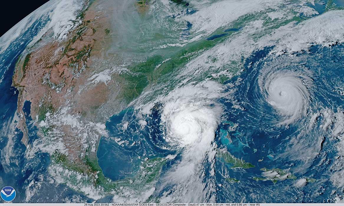
Last year’s Atlantic season produced 20 named storms, making it the fourth most active season on record. Of these named storms, seven developed into hurricanes and just one – Hurricane Idalia – made landfall as a Category 3 in August near Keaton Beach, Florida (the region’s strongest storm in more than 125 years).
The season’s higher activity was due to both warmer ocean temperatures and an intense El Niño event. While warmer waters can fuel stronger storms, El Niño’s vertical shear winds in the Atlantic can thwart storms from fully developing into hurricanes. The combination of the two factors led to a higher than anticipated season of activity, though one where most storms never made landfall. In a recap of the 2023 season, Matthew Rosencrans, lead hurricane forecaster at NOAA’s Climate Prediction Center, cited both factors as playing key roles: “The Atlantic basin produced the most named storms of any El Niño influenced year in the modern record. The record warm ocean temperatures in the Atlantic provided a strong counterbalance to the traditional El Niño impacts.”
While El Niño traditionally suppresses strong storms in the Atlantic, it can fuel them in the Pacific. However, both the Eastern Pacific (17 storms) and Central Pacific (four storms) fell within predicted ranges for the year.
As one of the strongest El Niños on record ends, La Niña is expected to develop by the summer and last into 2025. La Niña has the opposite effects of an El Niño in the Atlantic and Pacific basins. Since La Niña won’t feature increased vertical shear winds, Atlantic hurricanes are likely to occur more frequently. Concurrently, the already high oceanic heat in the Atlantic and Caribbean is expected to provide additional energy for storm development.
During the previous La Niña episode in 2020, the Atlantic experienced a record-breaking 30 tropical storms and a record-tying 14 hurricanes. Twelve of those storms made landfall in the United States between July and October 2020, causing over $40 billion in damages across the Gulf and South Atlantic coasts.
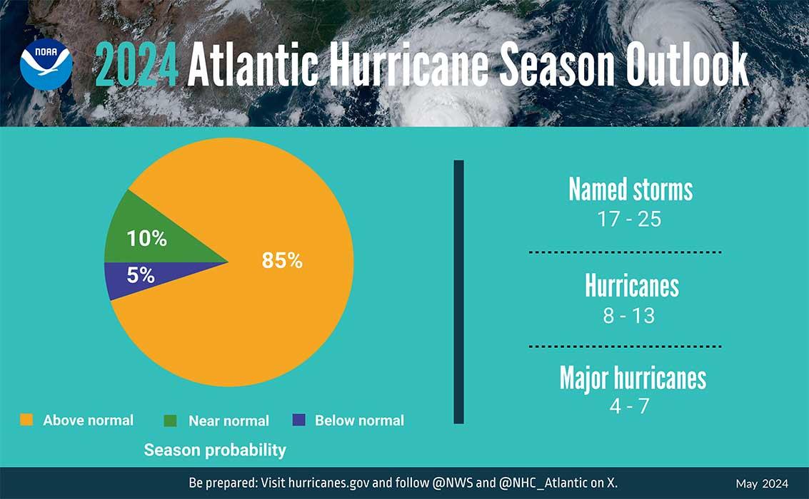
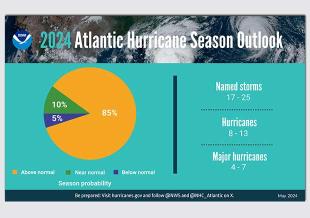
In its most aggressive preseason forecast ever issued, NOAA anticipates an “above normal” hurricane season due to the favorable combinations of La Niña and warm ocean temperatures, a season which could be an “extraordinary one in a number of ways” for the U.S. Gulf, South Atlantic and Eastern seaboards:
“NOAA is forecasting a range of 17 to 25 total named storms (winds of 39 mph or higher). Of those, eight to 13 are forecast to become hurricanes (winds of 74 mph or higher), including four to seven major hurricanes (Category 3, 4 or 5; with winds of 111 mph or higher). Forecasters have a 70% confidence in these ranges.”
The opposite is expected in the Central Pacific, where NOAA predicted a “below-normal” season, forecasting up to four tropical storms, which is a slight step back from a near-normal season of four or five tropical cyclones, including tropical depressions, storms and hurricanes.
Unlike other natural disasters, tropical storms and hurricanes are largely predictable, giving homeowners and facility managers plenty of time to prepare in case of emergency. However, weather conditions can change dramatically – all four Category 5 storms to make landfall in United States history were not hurricanes just days before impact –so additional planning and preparation ahead of time can make a significant difference in how well your structure and its occupants are fare.
Here are some tips to help:
Before the storm
After the storm
If your property has been affected by a hurricane, the first thing you’ll want to do is get in when it’s safe to assess the damage. But how do you know if it’s structurally safe? Here are a few things to look for to determine if your building is dangerous, has an undermined foundation or is otherwise structurally compromised:
If in doubt, we can help survey your property for you. Our firm has performed rapid assessments and building safety inspections for a variety of clients on a range of building types across the United States. We are ready to assist before, during and after any event to help keep your facility and its occupants safe and your business operations running smoothly.